Free Printable 50 States and Capitals Worksheets PDF for Kids
Learning all 50 states and capitals can feel overwhelming for young learners. Instead of relying on flashcards alone, hands-on activities help children remember where states are located, recognize their shapes, and connect each state with its capital.
These free printable 50 States and Capitals worksheets make geography practice fun while building important map skills.
Whether you’re homeschooling, teaching in the classroom, or just looking for extra geography practice, these worksheets are an easy, no-prep resource.
- Free 50 States Coloring Book (Printable PDF)
- 50 States Writing and Coloring Worksheets
- Printable 50 States Report Worksheets
What’s Included
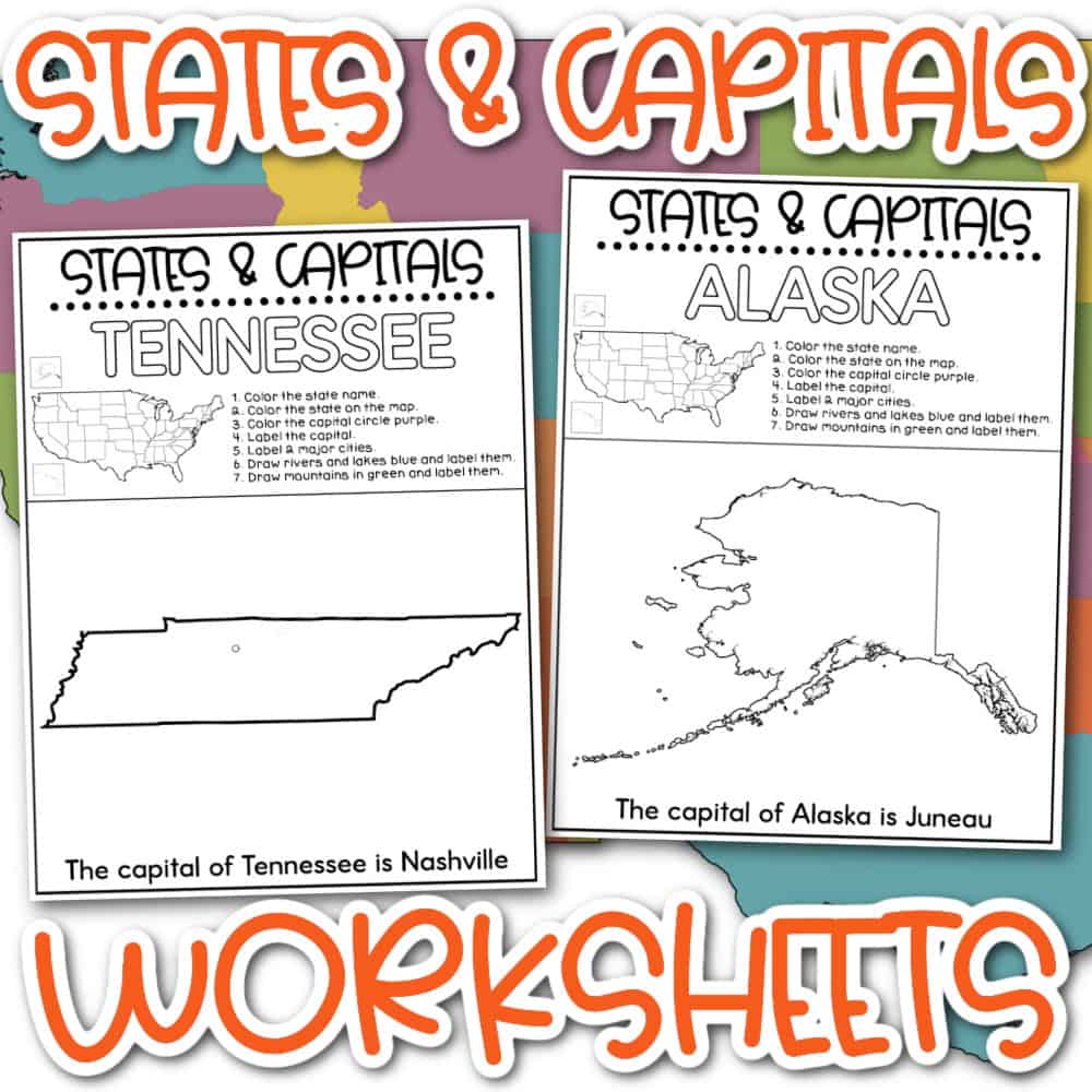
This printable PDF includes all 50 states, with one worksheet for each state.
Every page includes activities that help students learn through coloring, labeling, and writing.
Students will:
- Color the state name
- Color the state on a United States map
- Color the capital city
- Label the capital
- Label major cities
- Draw and label rivers and lakes
- Draw and label mountains
- Read and complete the sentence identifying the state’s capital
These activities combine geography, handwriting, map skills, and visual learning into one printable worksheet.
Download Your Free Printable 50 States and Capitals Worksheets
If you’re teaching U.S. geography, these printable worksheets make learning the states and capitals more engaging than memorizing lists alone.
Download the PDF, print the pages you need, and help students build confidence with geography through coloring, labeling, and map practice.
Why Use States and Capitals Worksheets?
Children learn geography best when they interact with maps instead of simply memorizing lists.
These worksheets encourage students to:
- recognize every state’s outline
- identify where states are located
- learn each capital city
- improve map-reading skills
- practice handwriting
- build geography vocabulary
The combination of coloring and labeling also helps many visual learners retain information longer.
Perfect For
These printable worksheets work well for:
- Homeschool geography
- Elementary classrooms
- Social studies centers
- Morning work
- Independent practice
- Early finishers
- Summer learning
- Substitute teacher activities
- Geography units
- U.S. history lessons
Grade Levels
These worksheets are ideal for:
- 2nd Grade
- 3rd Grade
- 4th Grade
- 5th Grade
Younger students can complete the coloring portions with adult assistance, while older elementary students can independently identify capitals, cities, rivers, and mountain ranges.
Skills Students Practice
Students build:
- United States geography
- State recognition
- Capital city identification
- Map skills
- Fine motor skills
- Handwriting
- Spatial awareness
- Social studies vocabulary
Are all 50 states included?
Yes! The printable PDF contains a worksheet for every U.S. state.
Are the state capitals included?
Yes. Each worksheet focuses on one state and includes the state’s capital city.
Are these Free States and Capitals Worksheets free?
Yes. You can download and print them for personal or classroom use.
What ages are these Free States and Capitals Worksheets best for?
These worksheets work best for elementary students in grades 2 through 5.
Can I use these Free States and Capitals Worksheets in my classroom?
Absolutely. Teachers can print multiple copies for classroom use.